


SoilMapp app for iPhone and iPad
Find out what’s beneath your feet with SoilMapp for iPad. Tap into the best available soil information from Australia’s national soil databases.
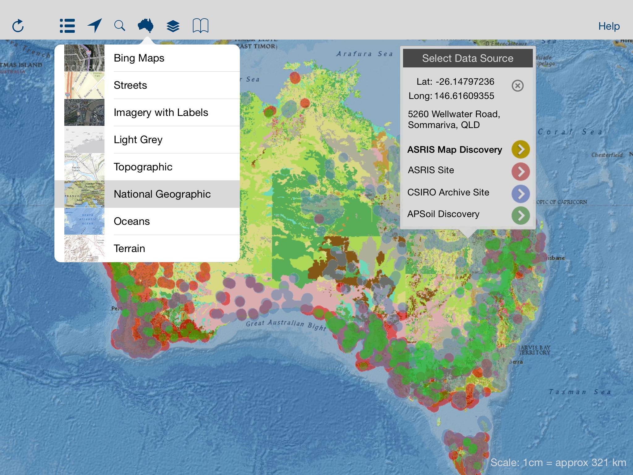
You can find out about the likely types of soil near you or you can look anywhere across the country.
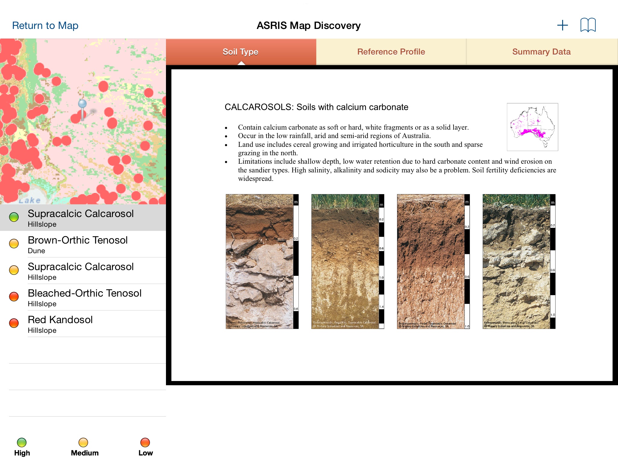
Discover the soil’s secrets, how it holds water, its clay content, acidity and other attributes important for agriculture and land management.
SoilMapp is designed to make soil information more accessible to help Australian farmers, consultants, planners, natural resource managers, researchers and people interested in soil.
SoilMapp has been developed by CSIRO, Australia’s national research agency, to allow direct access to the Australian Soil Resource Information System (ASRIS) and APSoil, the database behind the agricultural computer model: Agricultural Production Systems sIMulator (APSIM).
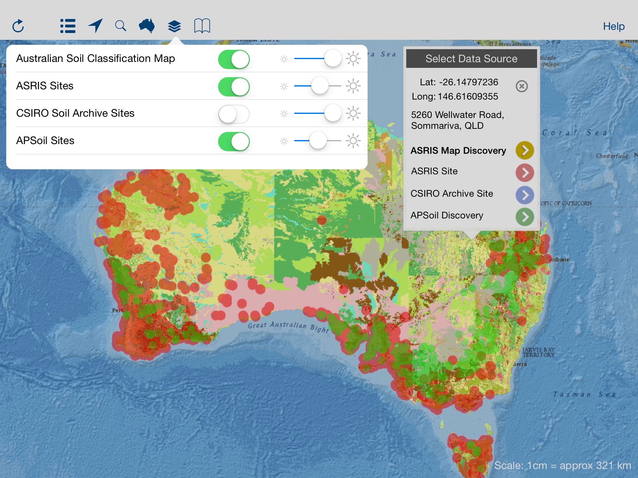
Users can pan and zoom the map and tap to locate a place of interest, or use the iPad GPS function to identify their current location. SoilMapp returns data and information about the likely soils at the defined location. This includes maps, photographs, satellite images, tables and graphs of data about soil attributes such asclay and organic carbon contents or pH. Data for specific described sites and samples held within the CSIRO National Soil Archive can also be accessed where available. APSoil sites provide details regarding soil water holding characteristics and other attributes essential for farming systems modelling.